Category: History

Cinematic

GRAPHIC DESIGN BY SAUL BASS.

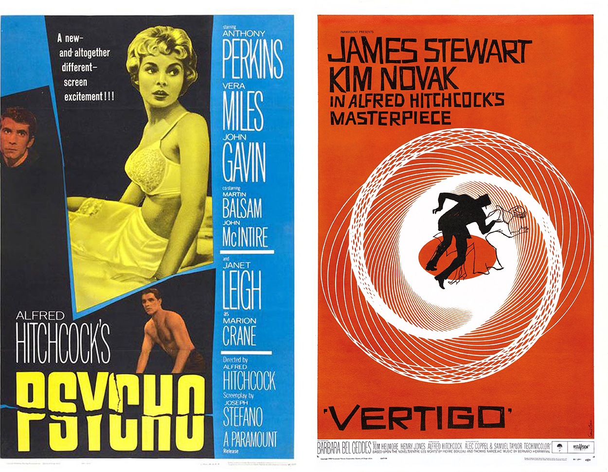
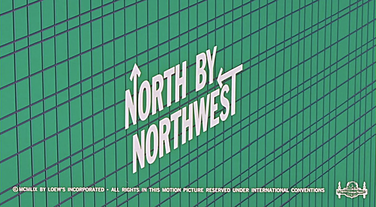
Many iconic movies of the mid-twentieth century featured the work of this legendary graphic designer. Like these three Hitchcock movies.

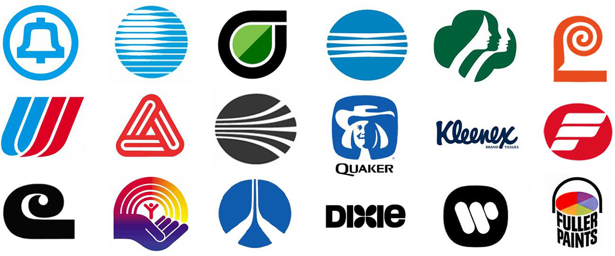
He also designed many well-known American logos.

A Google Doodle, lovingly-made by Matthew Cruickshank, celebrated Saul’s birthday. See the animation here: https://goo.gl/yjCZrK
Matthew’s website: http://yecrookedlegge.com

Unusual advertising

TWENTIETH-CENTURY PERSUASION.

It was a different world back then. Everyone smoked, even astronomers in the observatory.
“Have I discovered a new galaxy, or is it just the smoke from my cigarette?”

Your doctor would recommend his favorite brand of cigarettes.

Even Santa liked a few puffs before getting on his sleigh.

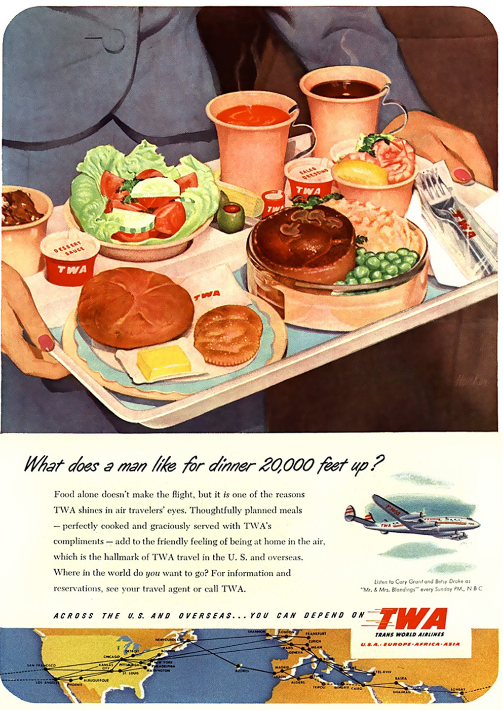
Airline food in the 1950s.

The modern reality.

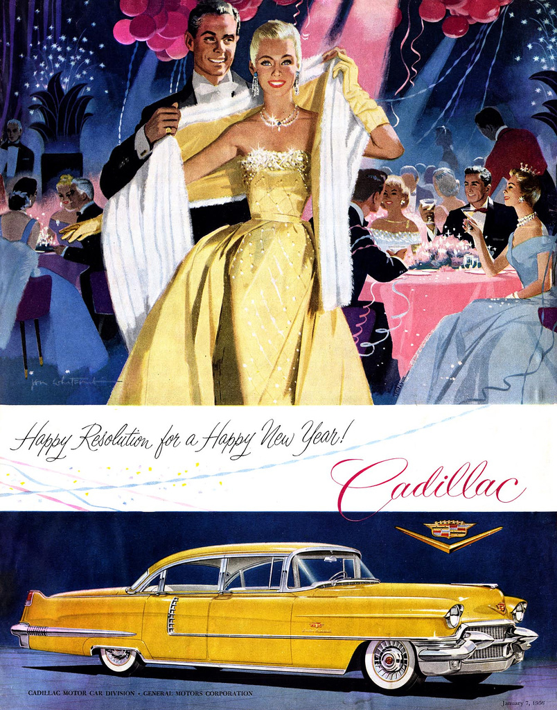
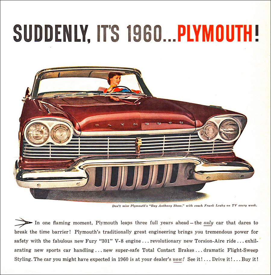
Cars clearly were glamorous. It’s a shame that they would only go a few miles on a gallon of gasoline.

“Flight-Sweep Styling.” Chrome-cleaner anyone?

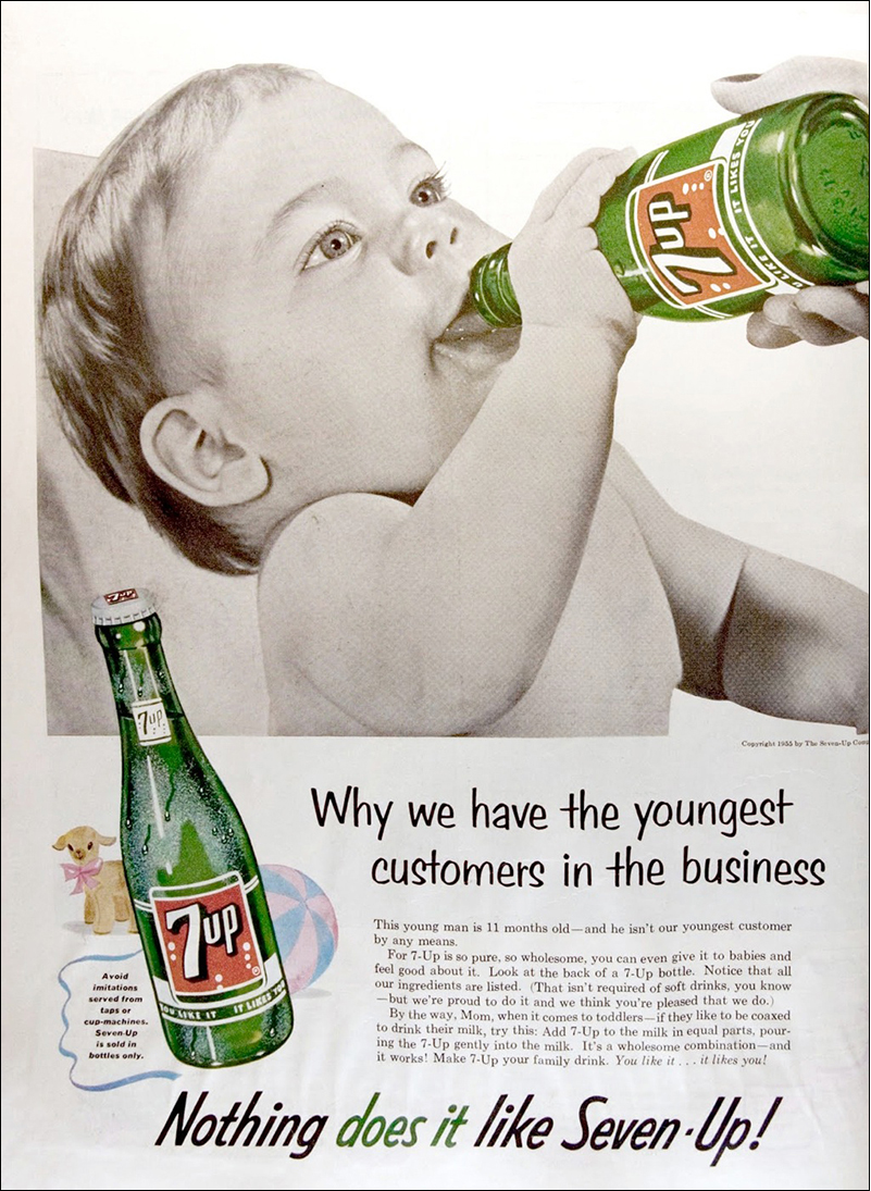
In those days, babies drank soda.

Stick maps

MICRONESIAN CARTOGRAPHY.

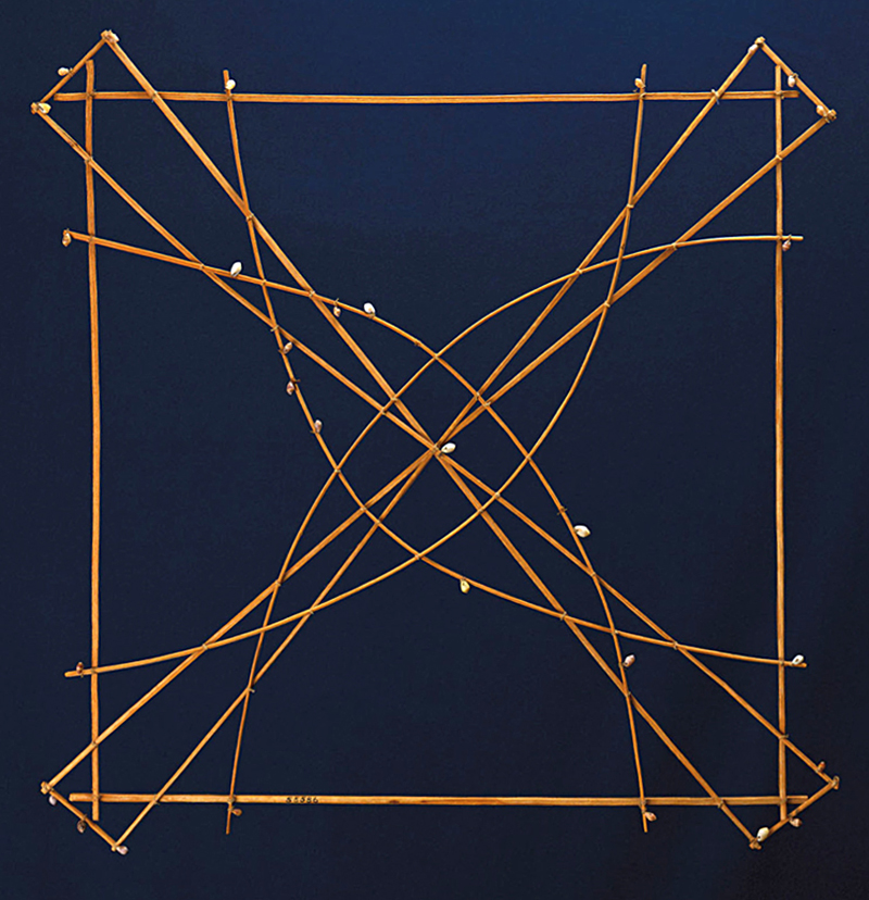
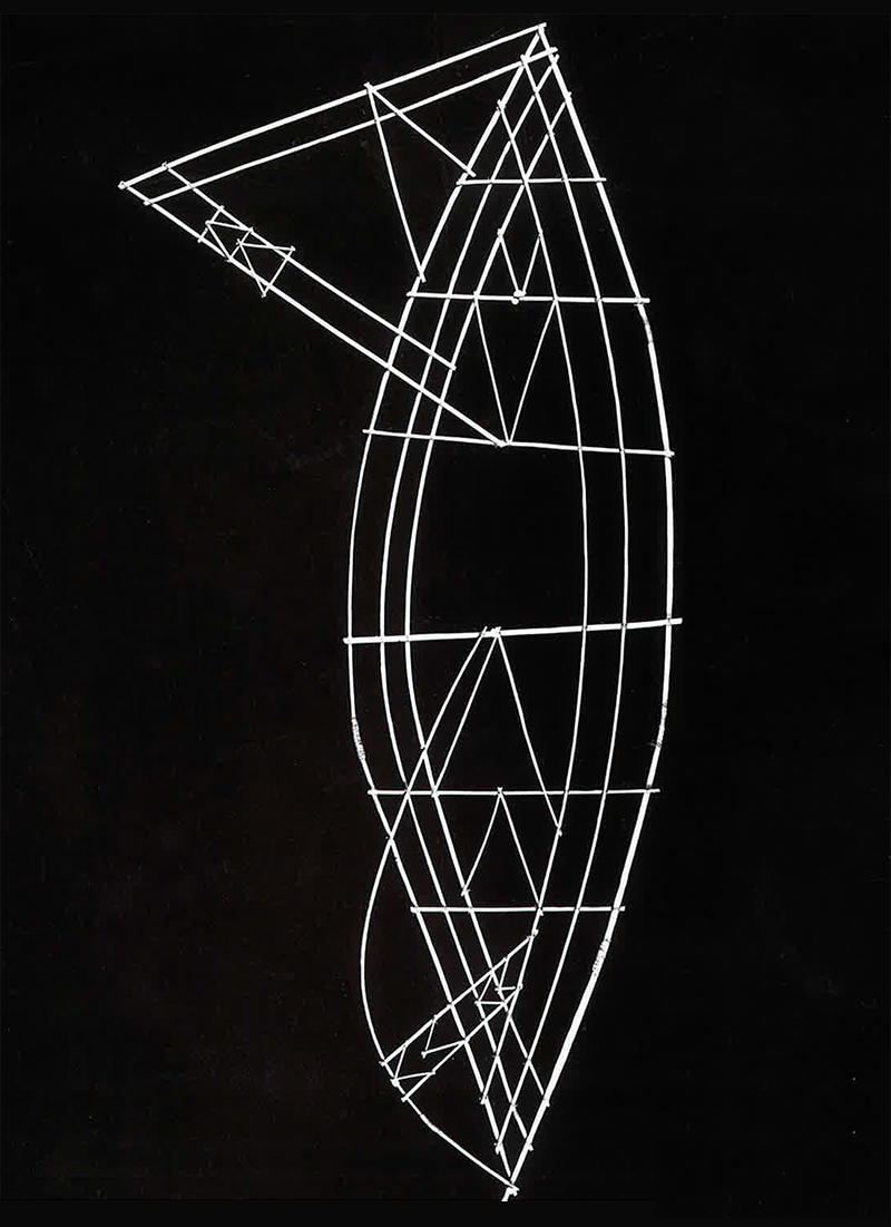
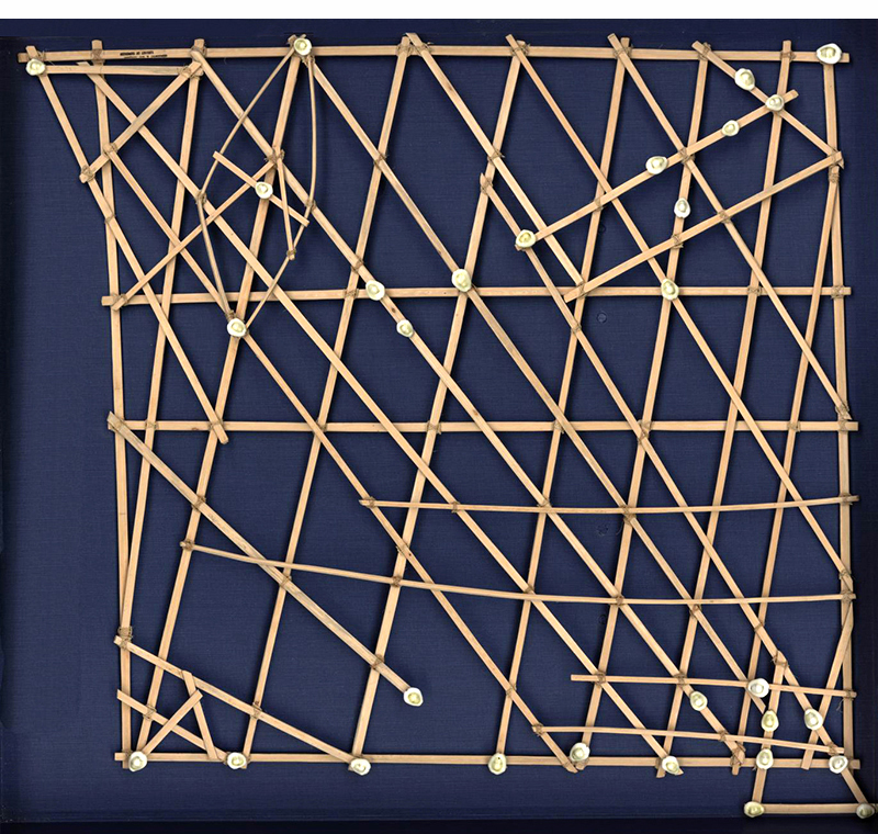
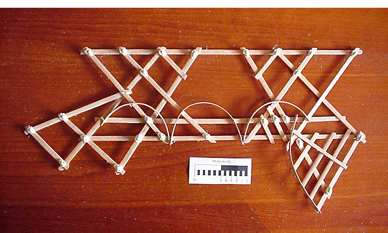
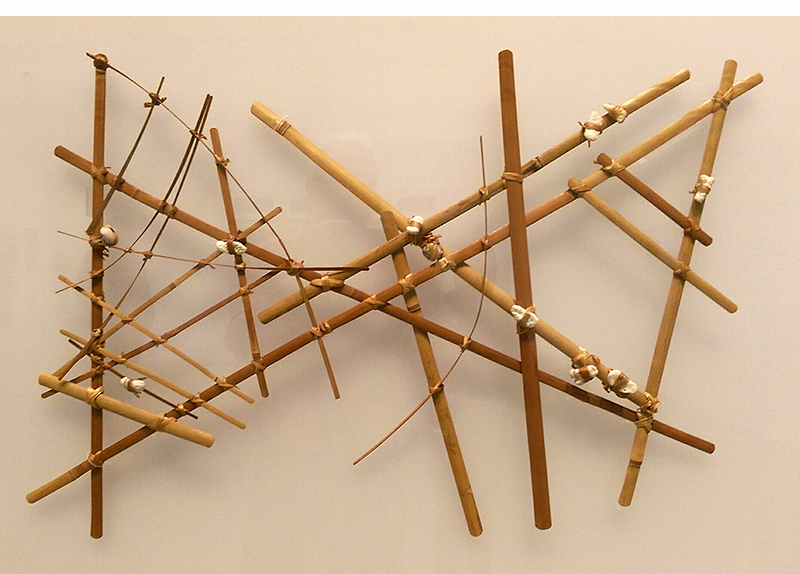
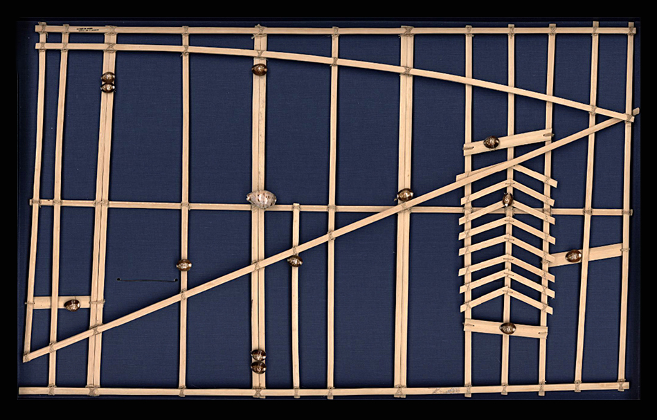
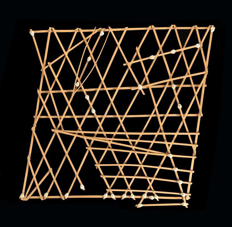
These charts were used by the inhabitants of the Marshall Islands to navigate their canoes. Shells represent islands. The ribs (made from the midribs of coconut fronds) show ocean swell patterns and currents. Often, only the person who made the map understood it, as there was no standardization between charts. The map-making process was handed down from father to son over many generations. A map was studied before a trip and was not referred to during the voyage.

There were three types of maps:
Mattang
An abstract small chart, used for teaching only.

Meddo
A close-up of a few islands with the main ocean swells.

Rebbelib
Shows a whole chain of islands and the swell patterns.

This mapping system was not revealed to Westerners until 1862, when a missionary reported it in “Nautical Magazine and Naval Chronicle.”

Camouflage

DESIGNED TO CONFUSE.

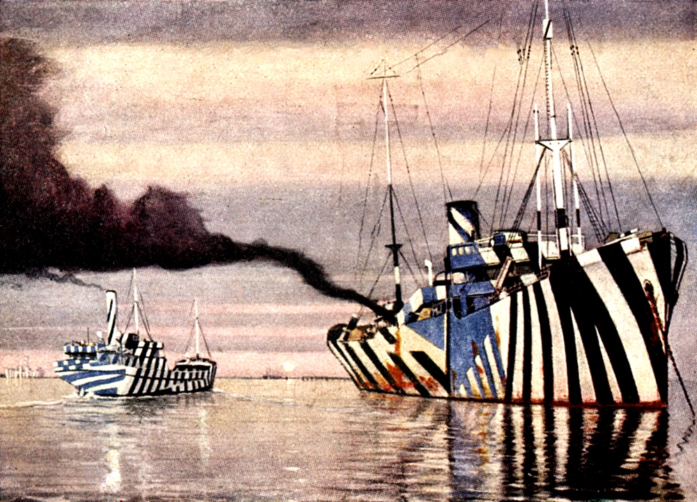
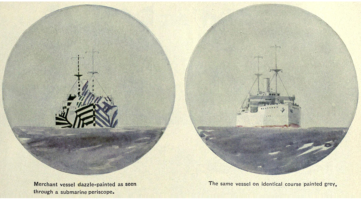
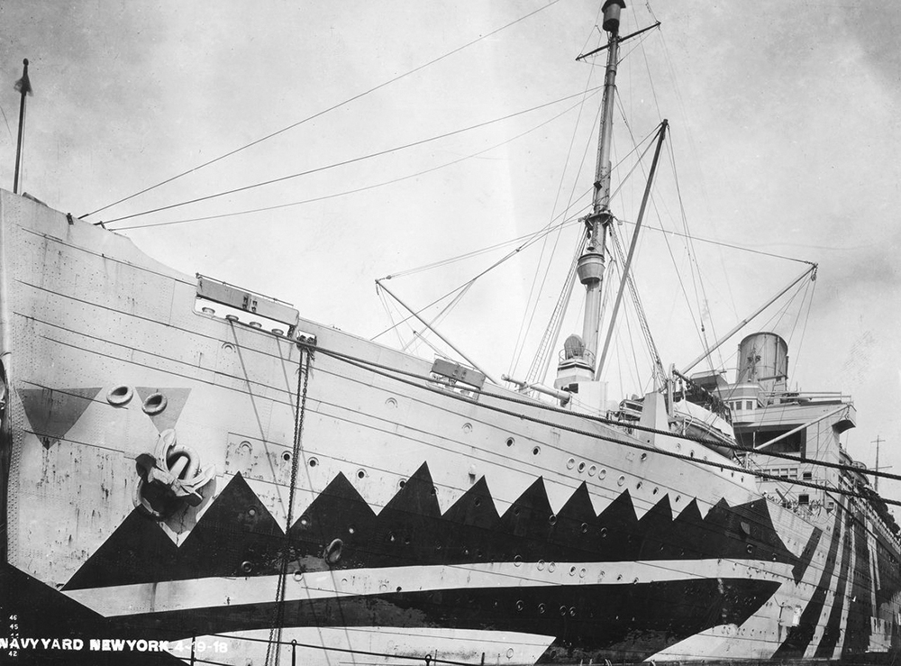
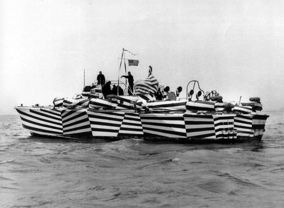
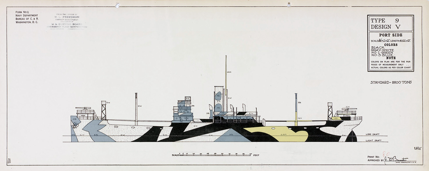
Dazzle painting (or razzle dazzle) was a World War I invention that was all about visual deception. Colors, patterns, lines and curved shapes were painted on ships to confuse enemy submarines. The effects were tested using models which where viewed from every angle, including through a periscope, to get an idea of how submarines would see them. The intention was to confuse attackers enough to make them miss, or to not even fire a torpedo at all. The 1918 painting above is by Burnell Poole. Picasso claimed that Cubists had invented dazzle camouflage, but the credit belongs to Norman Wilkinson, a British marine artist.

The photographs of these designs are all, of course, in black and white, but some strong color was often used.

Each ship had a unique scheme so that the enemy could not identify it by type.

I just had an idea. (Editor’s note: This doesn’t happen often.) Today, we might consider painting ships with some of those multi-colored pie charts from business presentations. They can confuse anyone.

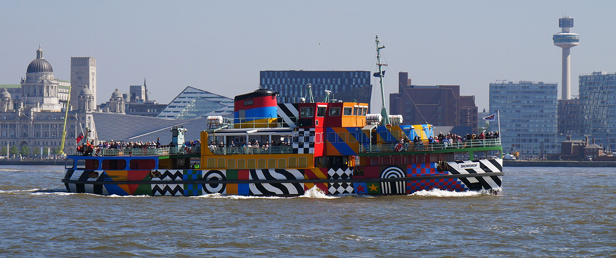
Dazzle ferry
“Everybody Razzle Dazzle, 2015,” a design created by Peter Blake as part of a program to mark the centenary of World War I. A bold new look for the Mersey ferry “Snowdrop.”

Photograph: iStock.com/Alan Morris

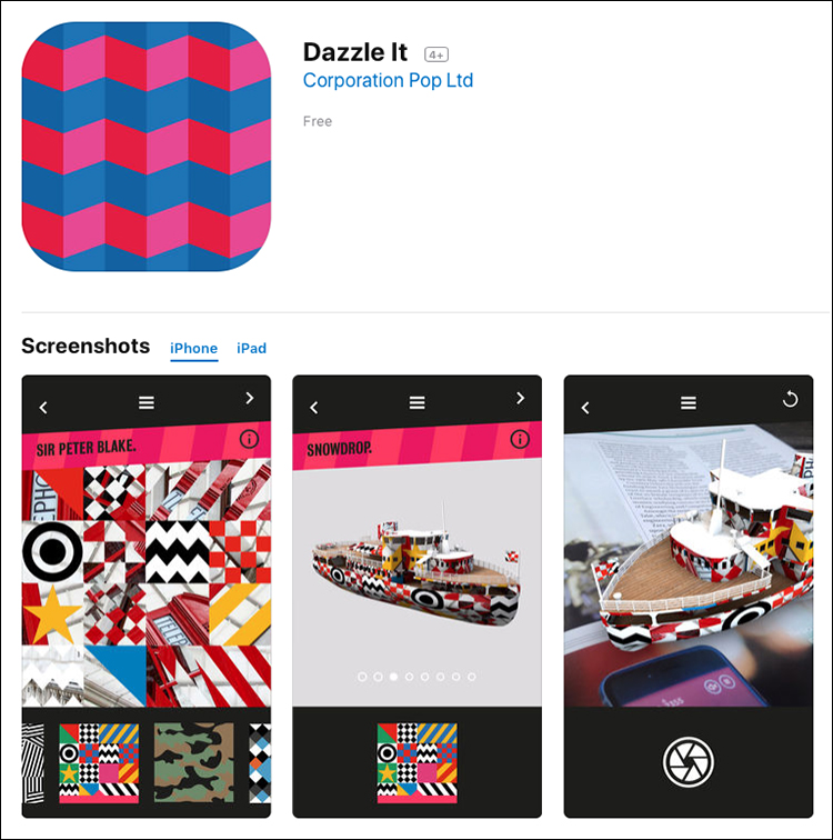
The project includes an app so that we can make our own dazzle patterns.

Pixelated
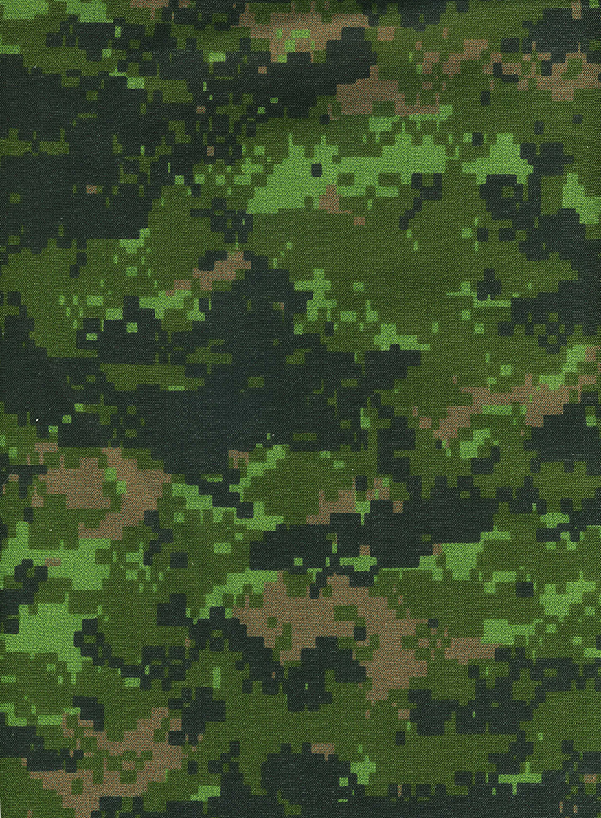
The Canadian armed forces were the first to use computer-generated camouflage, the Canadian Disruptive Pattern or CADPAT, which works well at different distances. There are three types: Temperate Woodland (TW) which is shown below, Arid Region (AR) and Winter/Arctic (WA).

OCP
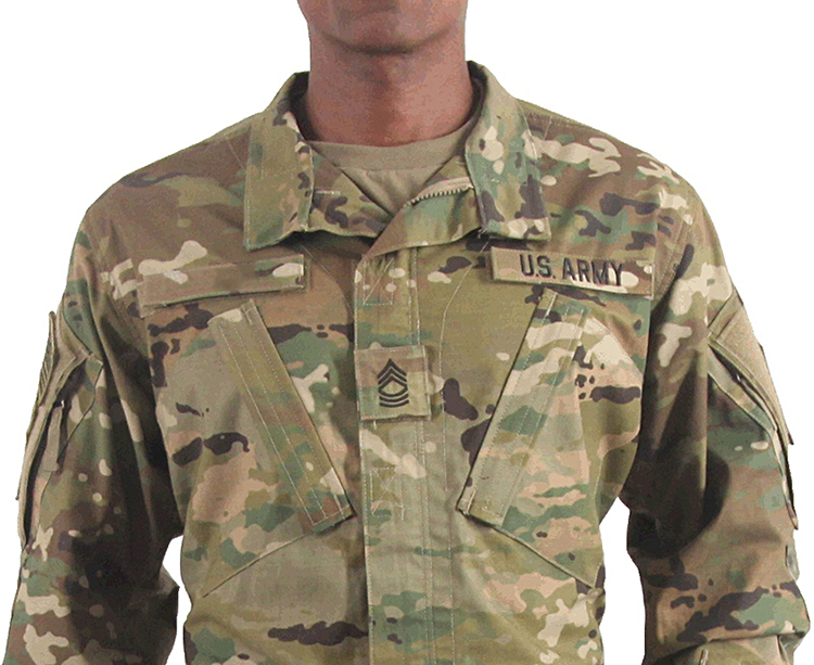
The Operational Camouflage Pattern is now the official combat design for U.S. soldiers.


Photograph: U.S. Army

If you want to know more about this subject, try the encyclopedia of camouflage (yes, there is one): http://camopedia.org/

Sweets (Candy)

CONFECTIONERY GRAPHICS.

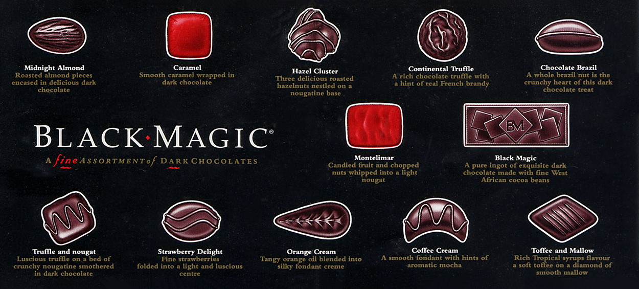
Selection guide A piece of simple, and useful, infographic magic. (Click on the image for a larger version.)

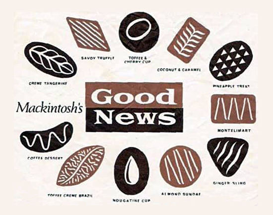
Savoy Truffle The lyrics of this 1968 Beatles’ song refer to Good News chocolates. They contain a warning about the risk of future dental problems: “…you’ll have to have them all pulled out.”

Creme Tangerine and Montelimar
A Ginger Sling with a pineapple heart
A Coffee Dessert, yes, you know it’s Good News
But you’ll have to have them all pulled out after the Savoy Truffle.

Hear it The section of “Savoy Truffle” described above is here: goo.gl/MdESas
Or get the full song on iTunes: goo.gl/hf4DsX

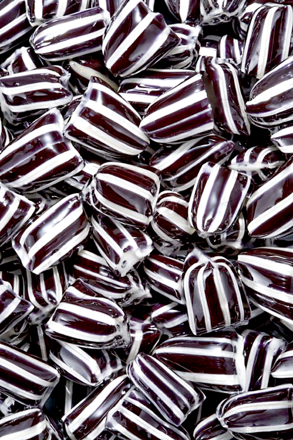
Sweet thesis My art school final project was called “Sweets.” I’m afraid that this unbelievably-great graphic artifact is lost deep in the vaults of the massive Grimwade Museum of Infographics (which is on the Isle of Sheppey), but I do remember that one component was photographs of Everton Mints. There’s something inherently graphic about many types of confectionary.

Photograph © Mark Fairey/123rf

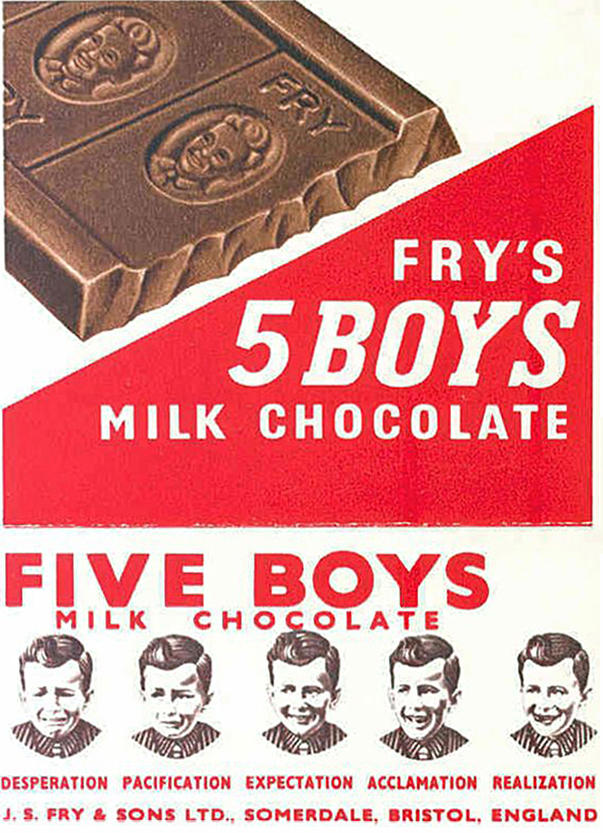
Five Boys My favorite vintage candy label contains a strange message. What does it mean?
Are these the five stages of an infographic project?

Leonardo who?

THE FIRST, AND THE GREATEST, GRAPHICS DIRECTOR

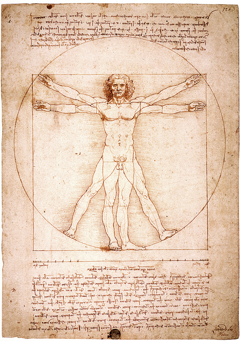
Leonardo da Vinci (1452–1519) was so ridiculously multi-talented, that it’s hard to believe he existed. Leonardo often wrote backwards for reasons that are not entirely clear, perhaps as he was left-handed, it meant that he didn’t smudge the ink. Anyway, a genius of his magnitude can do whatever the hell he wants. The Vitruvian Man (above) is just one of many iconic images Leonardo created (the Mona Lisa is top of that list). The drawing is based on the relationship of ideal human proportions to geometry, as described by the Roman architect, Vitruvius, who considered them to be fundamental to classical architecture.
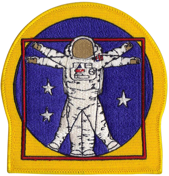
References to the Vitruvian Man appear all over the place. An example: NASA’s extravehicular activity (EVA) arm patch.

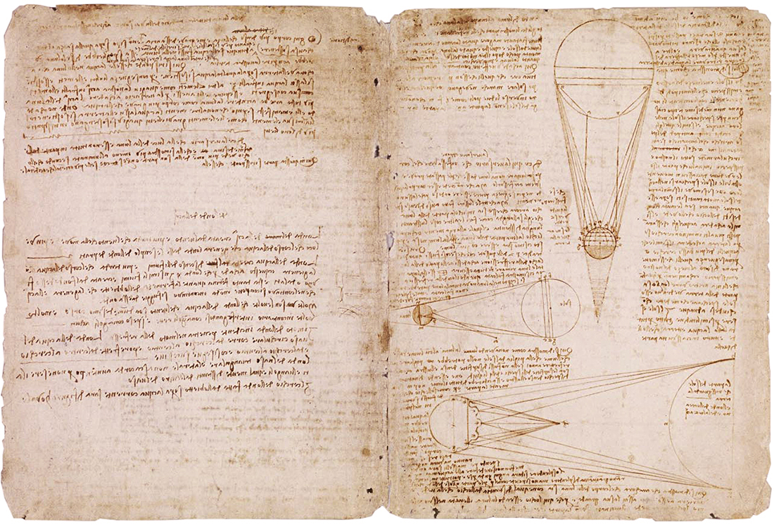
From the Codex Leicester (also known as the Codex Hammer), which is owned by Bill Gates. 18 sheets of paper full of ideas and observations about topics like water, geology, and light from the moon.

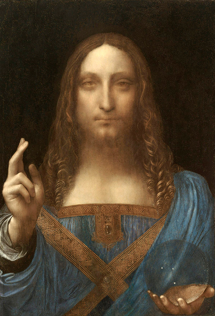
“Salvator Mundi,” sold for $450.3 million on November 15, which is a new world auction record for any piece of art.

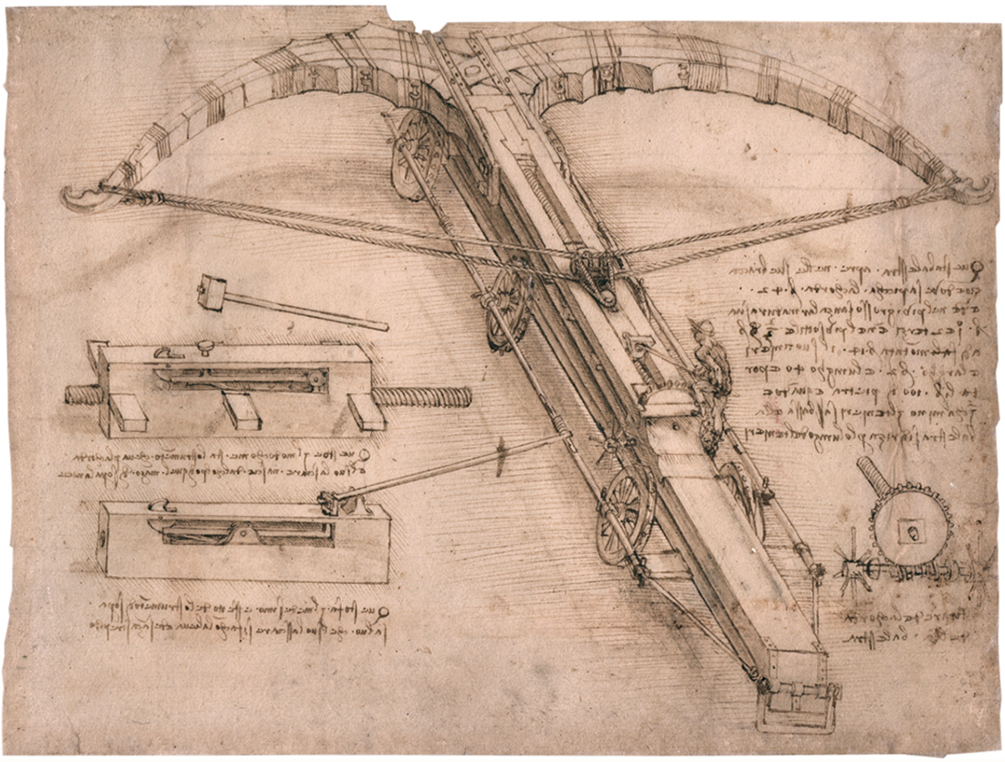
We all know about Leonardo’s many inventions: flying machines, solar power etc. In an era of conflicts all over Europe, it’s not surprising that war machines were on his mind. Hence this design for a giant crossbow. Note the size of the operator.

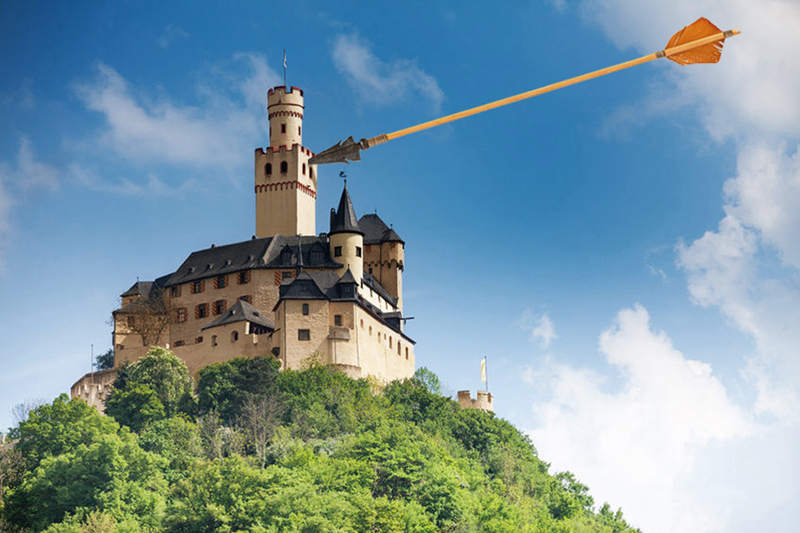
Had this weapon ever been put into use, the results would have been interesting.

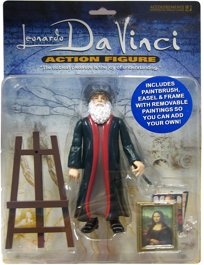
Perhaps it’s time to get your Leonardo action figure. The quote on the box says it all.

Photographs above © Sergey Novikov/123rf, Burmakin Andrey/123rf

DNA

PRINTING THE GENOME, AND THE DOUBLE HELIX STORAGE SOLUTION.

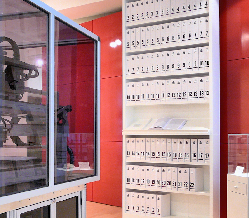
The Wellcome genome bookcase 118 books, each a thousand pages long, contain the 3.4 billion letters of DNA code that make up the human genome, displayed in a type size of 4.5 pts. The bookcase is part of the Welcome Collection in London.


Photograph by Russ London.

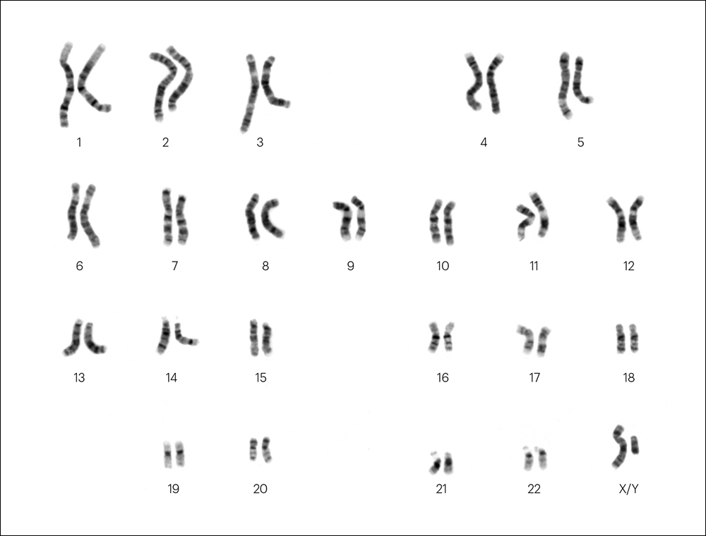
The books are numbered for the 22 pairs of chromosomes, plus X and Y. Below, the male karotype.


National Human Genome Research Institute.

Ultimate storage Our DNA carries all this information with an incredible degree of compactness. As a result, researchers are developing techniques to use DNA to store data. A single gram could potentially hold 215 million gigabytes. The artificially created strands can be read by sequencing machines. Another big plus is that DNA has the potential to last for hundreds of thousands of years, if stored correctly.

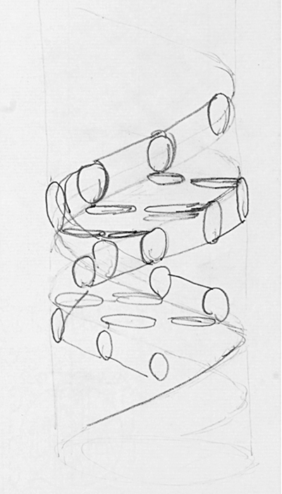
Below, the first published illustration of the double helix (in “Nature,” 1953), illustrated by Odile Crick. She was married to Francis Crick, who discovered the structure of the DNA molecule with James Watson.

A more developed version from “Nature” in 1968.

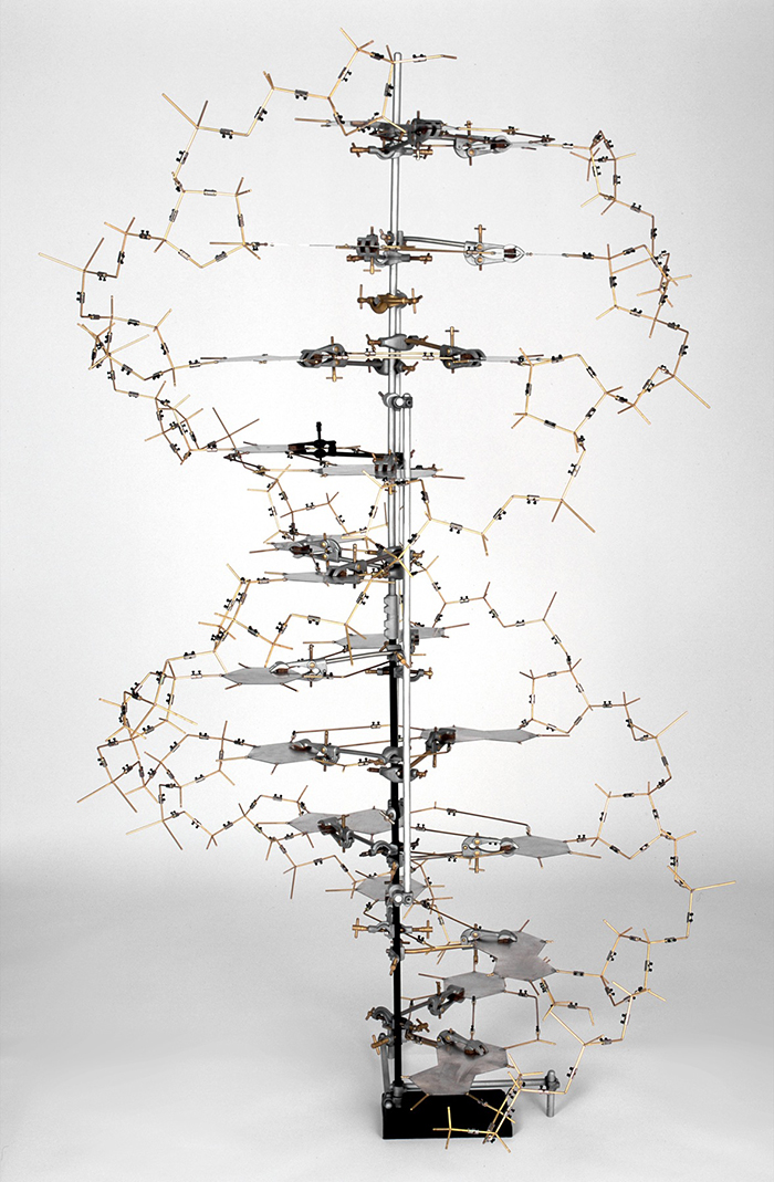
A replica of Crick and Watson’s original DNA model.


MRC Laboratory of Molecular Biology.

Crick’s original drawing.

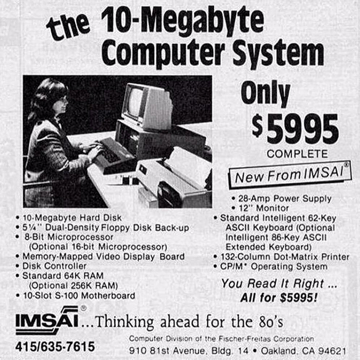
Data storage footnote Back in the early 1980s, 10 megabyte storage was really something (and really expensive).
That’s about $10,000 in today’s dollars.

This computer from the late 1970s cost $24,000 (adjusted for inflation).

Color wheels

TRADITIONAL THEORY FOR ARTISTS AND DESIGNERS.

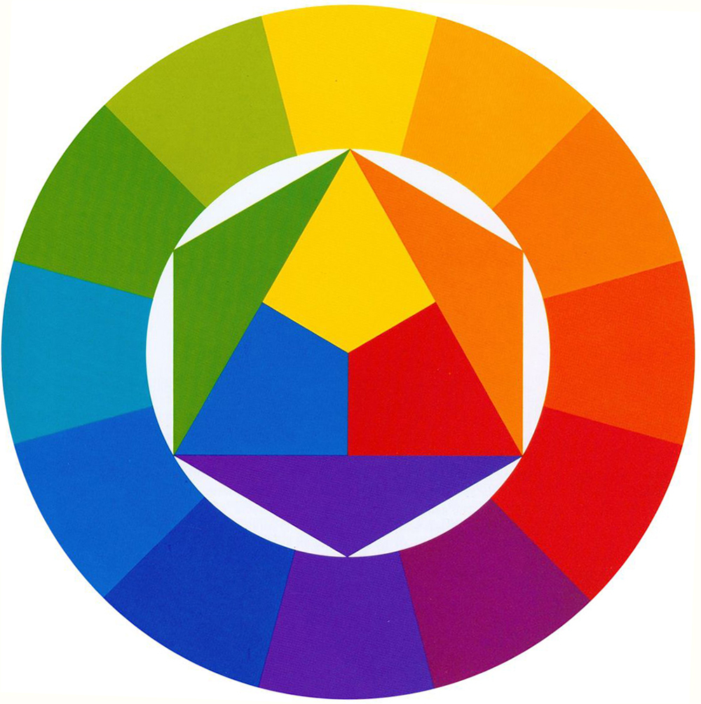
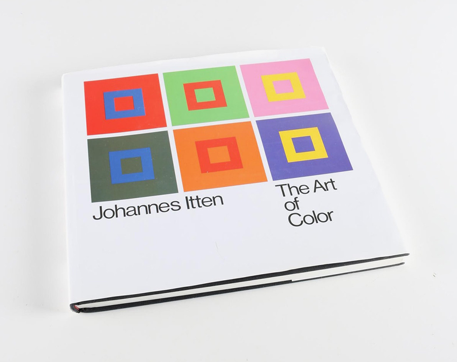
Above,“Farbkreis” from “The Art of Color” (1961), by Johannes Itten, a Swiss painter and theorist who taught at the Bauhaus. This 12-hue circle is made up of three primary, three secondary and six tertiary colors.

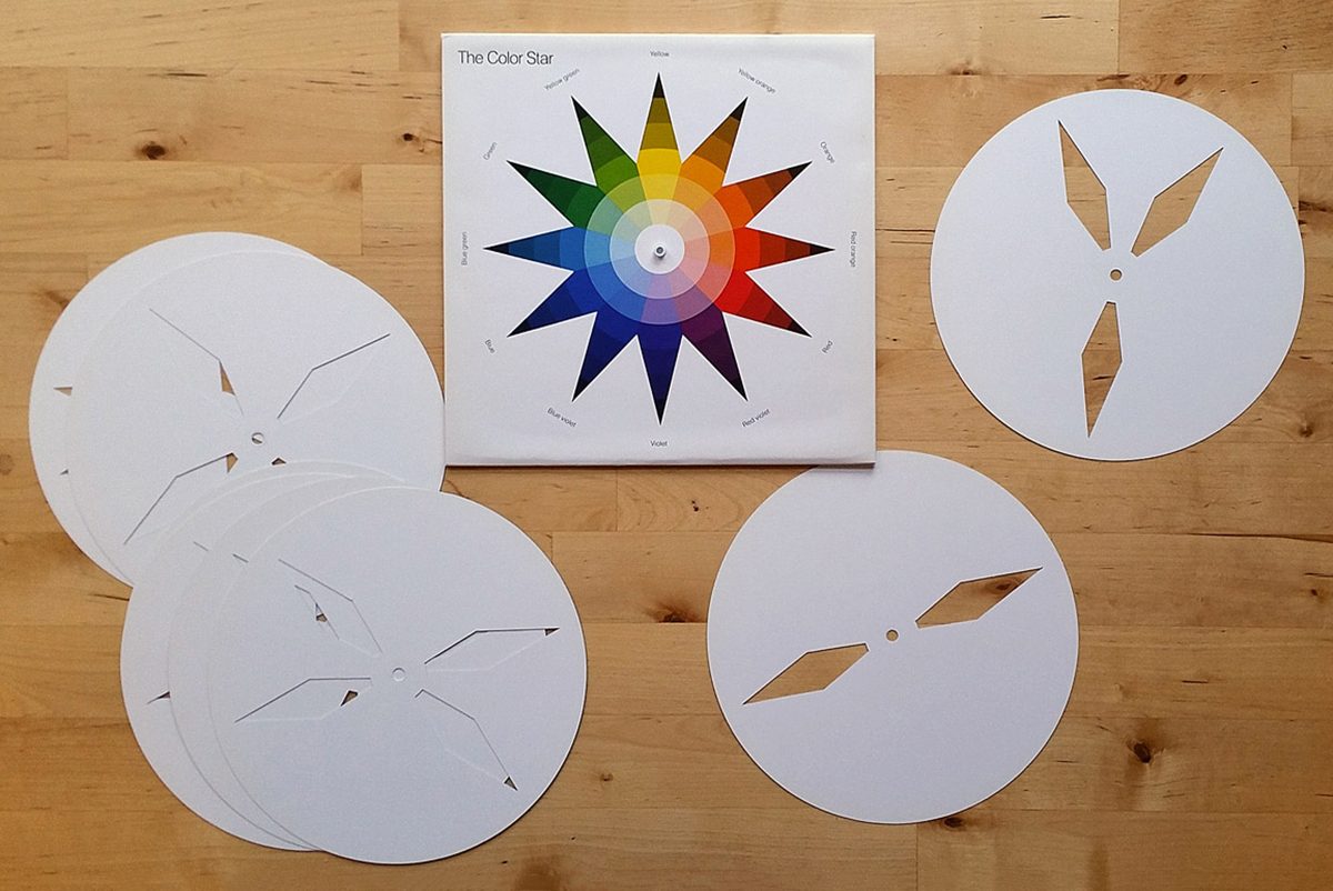
“The Color Star” (1986) has eight disks with cut-outs that can be rotated over Itten’s star to compare colors.

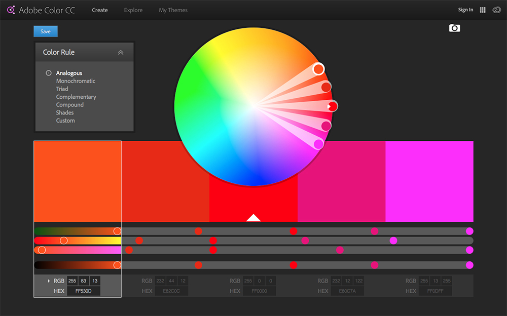
Now we have so many excellent digital color aids, like Adobe Color: https://color.adobe.com/create/color-wheel/

But… I still remember art theory classes way back in art college. They were not that easy (we used to moan about them), but in retrospect, it was important knowledge. The basic concepts: primary, secondary, and tertiary colors (primary and secondary mixed). Hue, saturation, temperature, and so on. I know I sound like a dinosaur (and I do certainly fit that description), but I wish my students had a color theory class. These are valuable lessons to learn.

Color Wheel 101: Complimentary colors are opposite each other. Analagous colors are next to each other. White, which represents all color, is in the center.

Some historical examples:

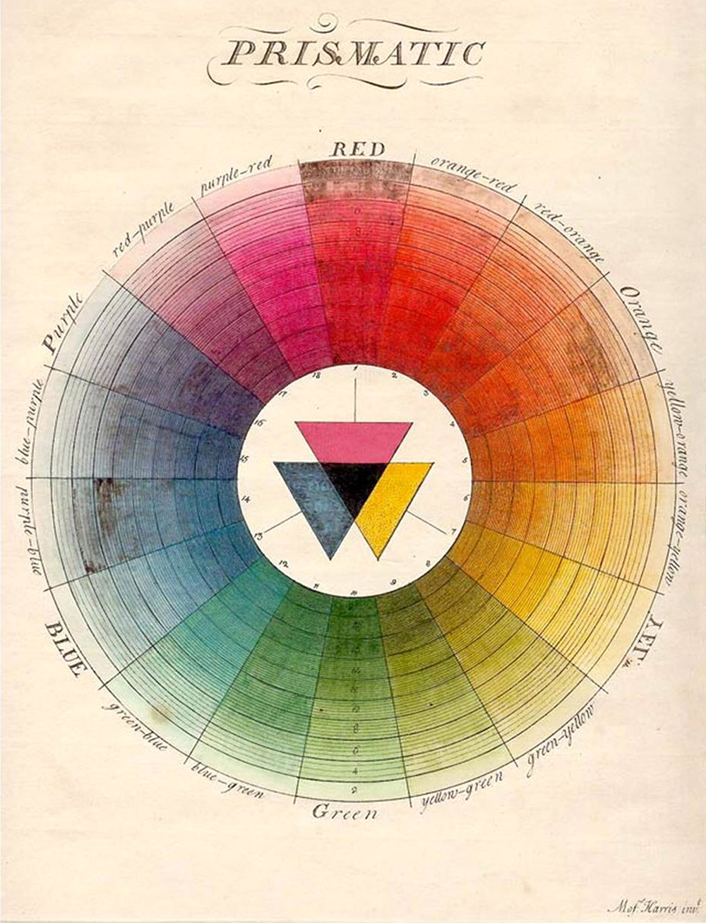
From “The Natural System of Colors” by Moses Harris, 1776.

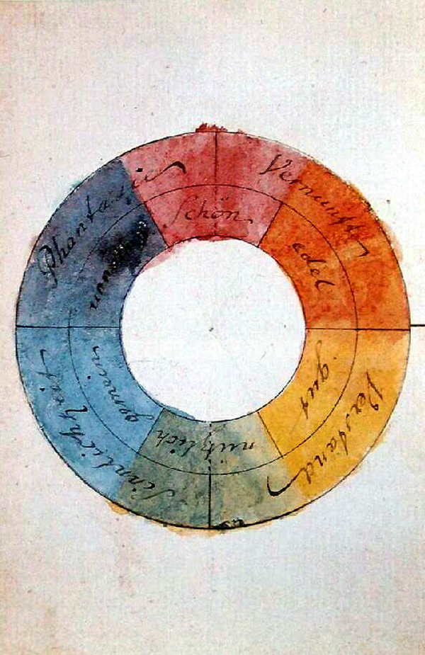
From “Theory of Colors” by Johann Wolfgang von Geothe,1810.

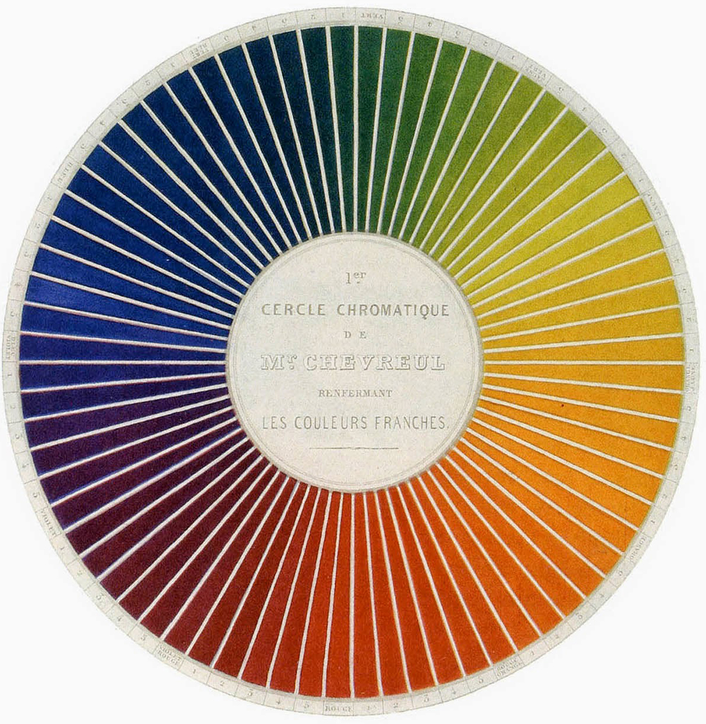
From “The Principles of Harmony and Contrast of Colors” by Michel Chevreul, 1839. A 72-part circle.

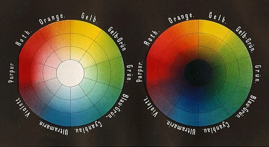
“Color Panel” by Wilhelm von Bezold from “The Theory of Colors in Arts and Crafts,” 1874.

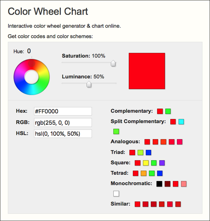
There are many online color wheels like this one, in RGB: goo.gl/xeK49A

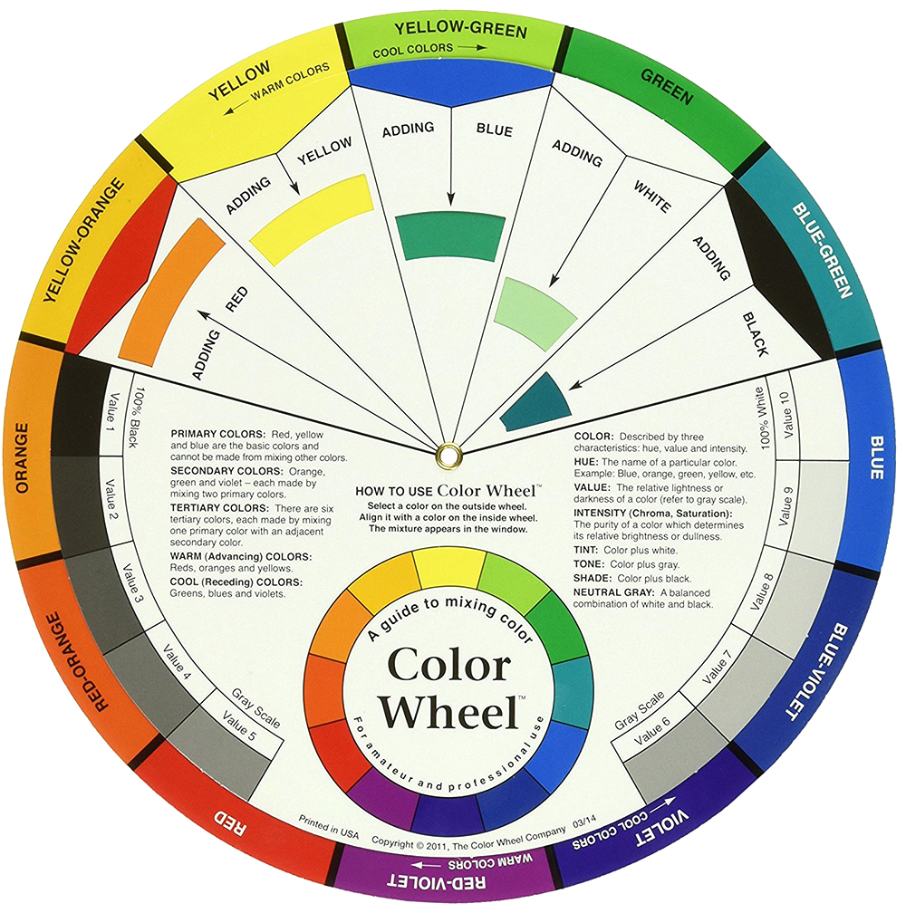
And analog ones are available, like this: goo.gl/CQjvDd

A previous post about the color books used to choose CMYK colors in the pre-computer era: https://wp.me/s7LiLW-cmyk

Wall charts

IMPRESSIVE EXAMPLES FROM THE LAST CENTURY.
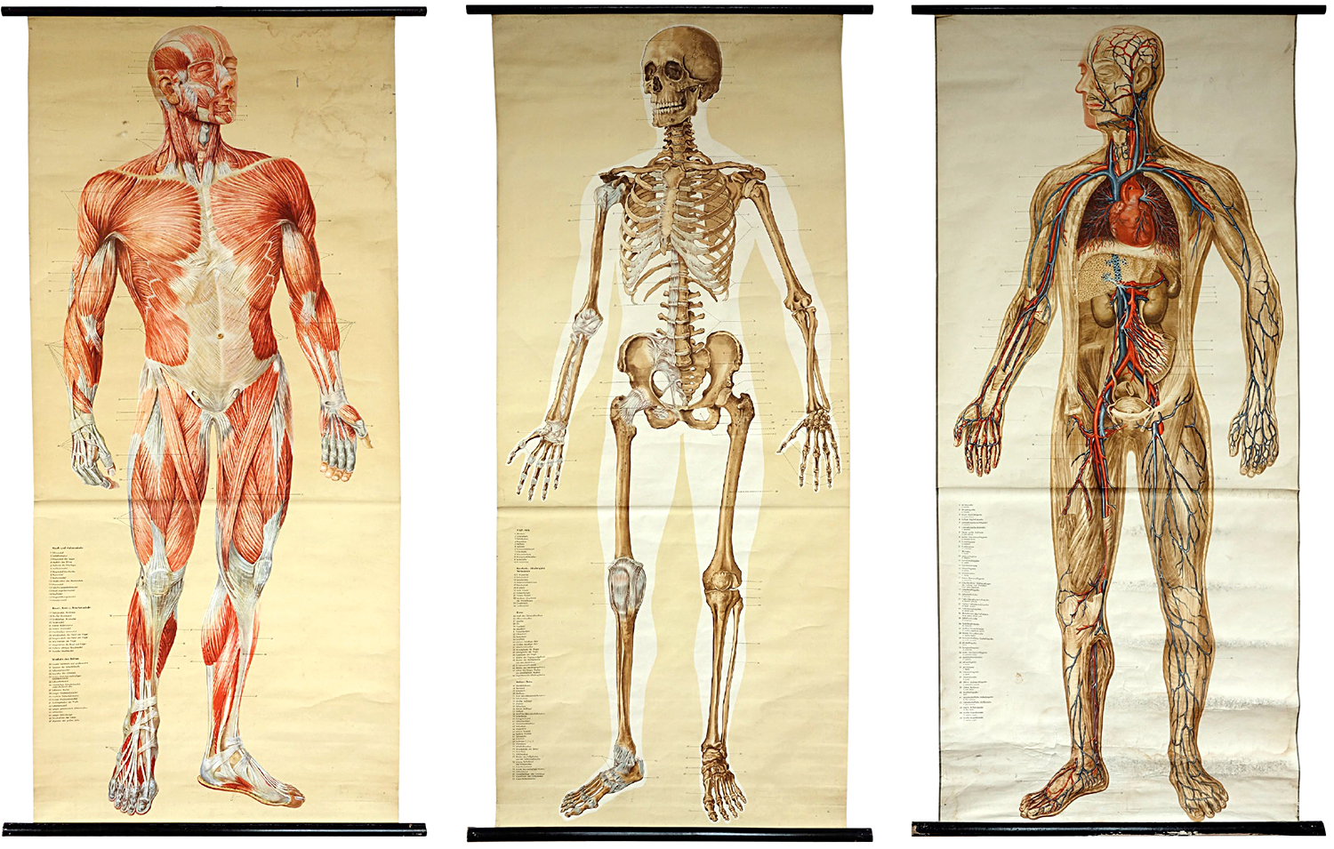
It’s time for another visit to Michael Stoll’s superb collection of historical graphics. Before the computer, these big infographics were essential teaching aids. Of course, their (mostly inferior) descendants are common in classrooms today. I asked Michael for his general thoughts about this genre and some comments about these examples.

“Wall charts are a dying species in an era where everything is digitized and online. This is a shame, because having something physically present in a classroom and encouraging a conversation about it, makes more of an impression than a screen, especially as these charts are so large.

I remember being sent by a teacher to the wall chart room at our school to get a particular example. I spent more time just looking at the other charts (there were a huge number of them) instead of concentrating on the task. As a teacher myself, I often wonder how other teachers used these charts to explain things to their pupils. A wall chart can be seen as a didactic element. It emphasizes visualization over explanation. Wall charts were also used as promotional material by companies, that wanted to enable deeper understanding of their products, or provide background information.”

Anatomy (Shown above) Naturalien und Lehrmittel, Anatomie, Biologie Tanck & Wegelin, Hamburg Altona. c.1950
“These are considered to be the most accurate anatomical charts. While each one will work on its own, I love the effect of the series. The reader can jump between them and make comparisons or draw conclusions.”

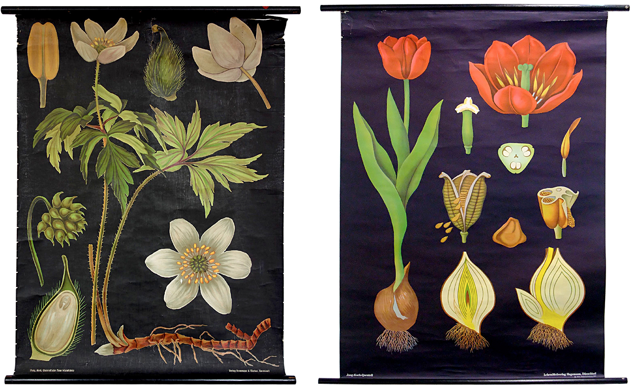
Botany (Shown below) Jung, Koch, Quentell—Lehrmittelverlag Hagemann, Düsseldorf. c.1963
“Two rather old examples from the world-famous publisher. While the newer ones are offset printed, the older ones were produced using lithographic printing, which provides a lot of detail. The arrangement is fascinating, in that the chart still works although the parts of the plants are not to scale. This is called adaptive scaling. And the items stand out clearly against the black background.
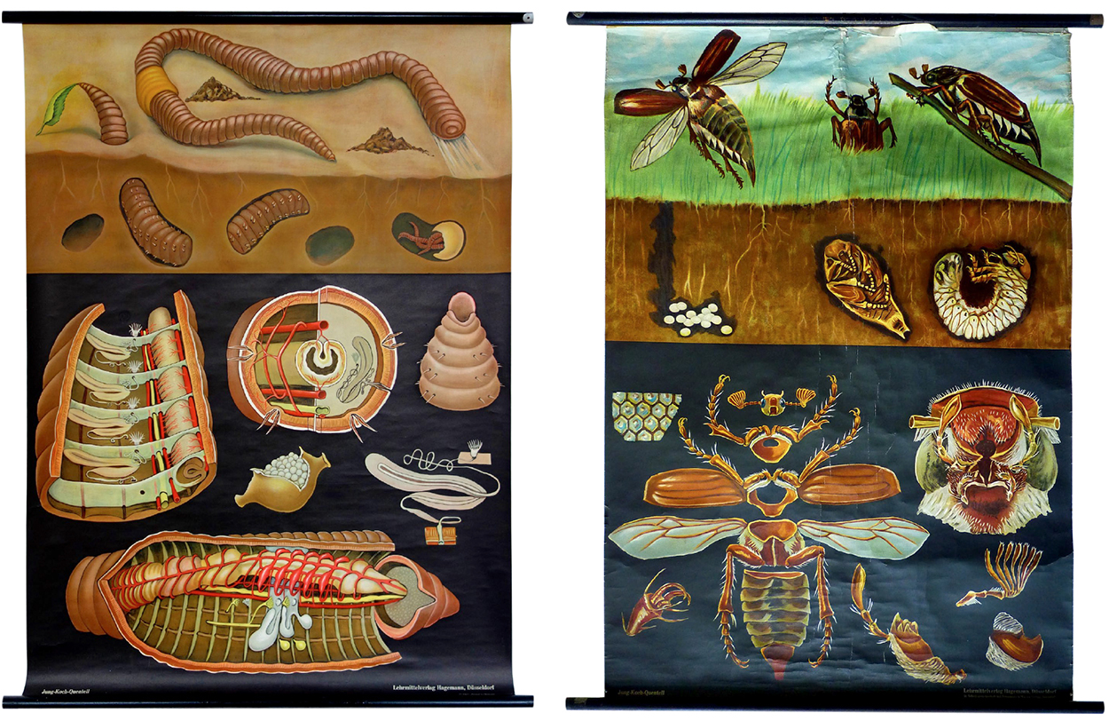
Insects Jung, Koch, Quentell. c.1963
“The layout is set up in three logical stages: what we normally see (which references what the reader recognizes), what is going on hidden from the human eye (which connects this information to what we normally see), and a very detailed deconstruction of the animal (which has the highest density of information).”
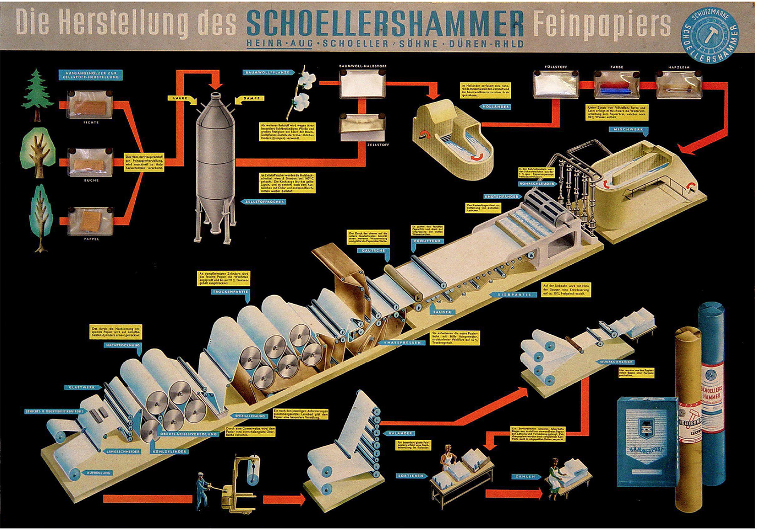
Paper production “Mounted onto stiff cardboard, this chart takes one further step: there are samples of real wood, chemicals and colors sealed in small plastic bags which are attached to the poster.”
(Editor’s note: I’ve used the red line a lot in my graphics: http://wp.me/p7LiLW-IP)
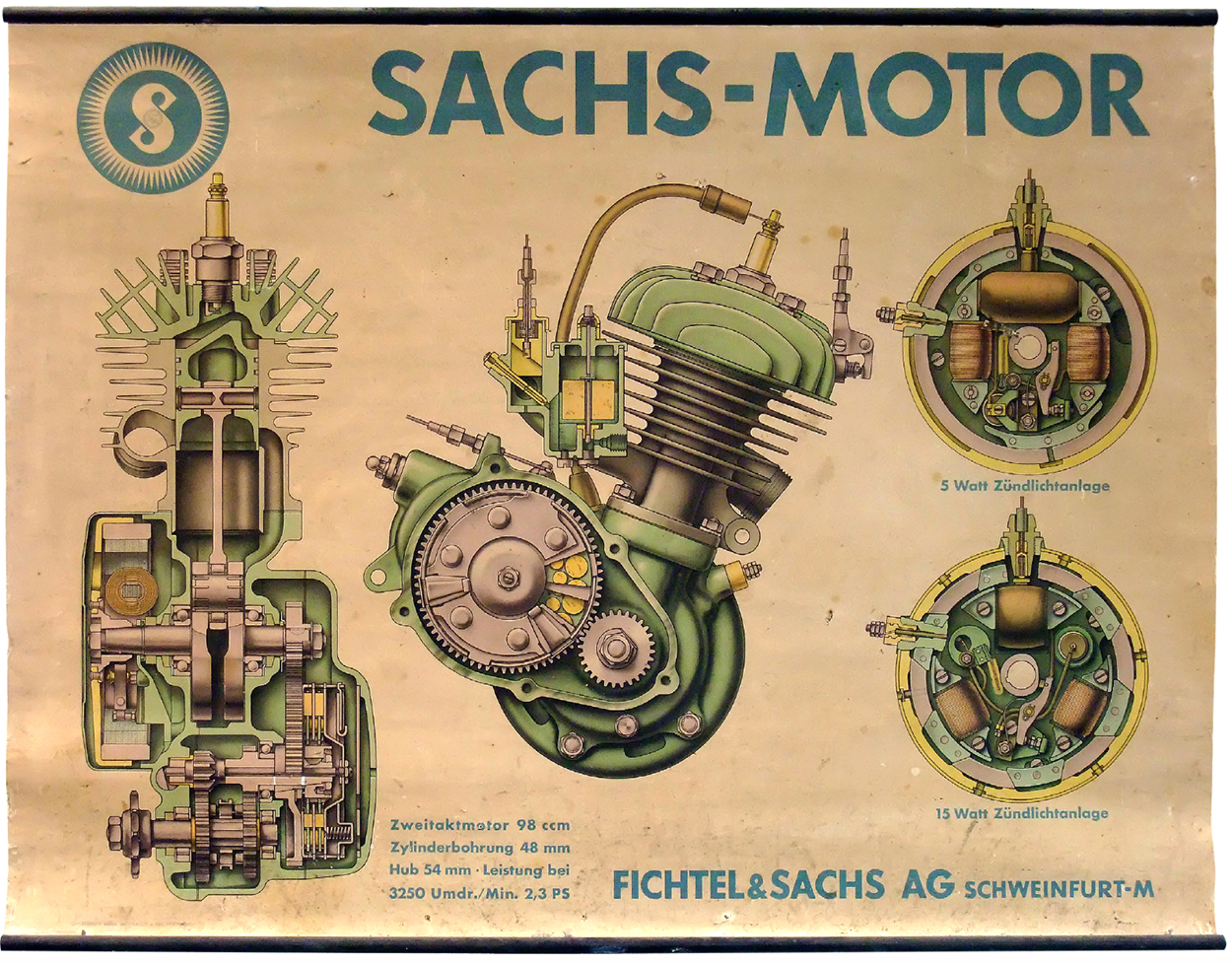
Engine Beautifully rendered, lithographic printing. Larger than actual size. This scaling allows more detail.
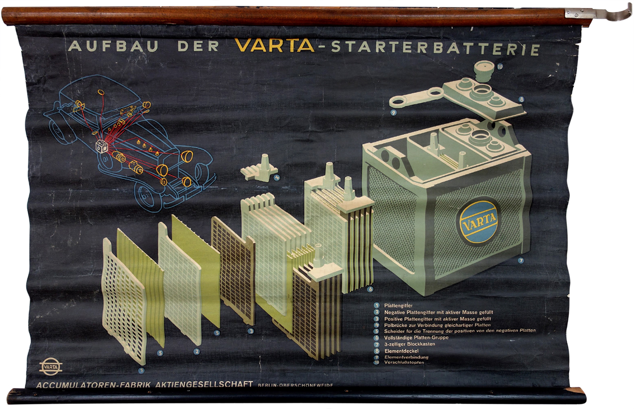
Battery “Also printed using the lithographic process. The car diagram shows the relevance of a battery like this. This chart is a visual depiction of how important electricity was for cars back then.”
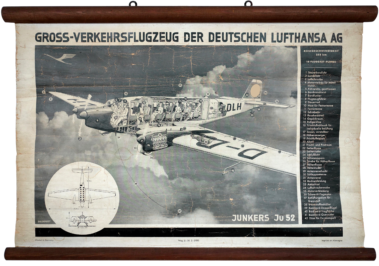
Aircraft “The chassis of this plane was made entirely from aluminum. I followed this example on eBay, and the price skyrocketed. I eventually bought it, but wondered about the high price. So I contacted the manufacturer, and found out that these charts were delivered with the aircraft. And there were only two models with these engines delivered.”
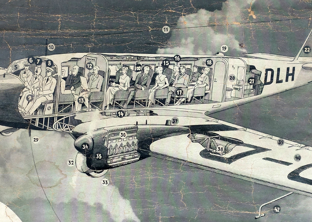
Detail.
The much more common Ju52/m3.
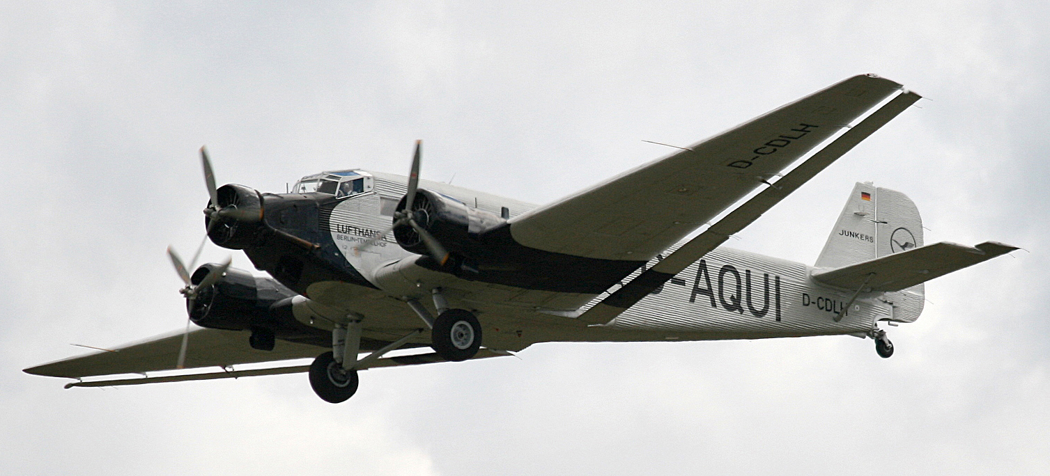

Photograph by Rror.

Previous posts from Michael’s collection:
Eye model: http://wp.me/p7LiLW-1yx
Flap books: http://wp.me/p7LiLW-IV
Flight thru Instruments: http://wp.me/p7LiLW-Rr
Herbert Bayer’s Geo-Graphic Atlas: http://wp.me/p7LiLW-xO
The Atlas to Alexander von Humboldt’s “Kosmos”: http://wp.me/p7LiLW-jO

Michael Stoll teaches media theory and infographics at the Augsburg University of Applied Sciences, where he is head of the information design study track in the Department of Design.
Mercator projection

FROM THE SIXTEENTH CENTURY TO GOOGLE MAPS.

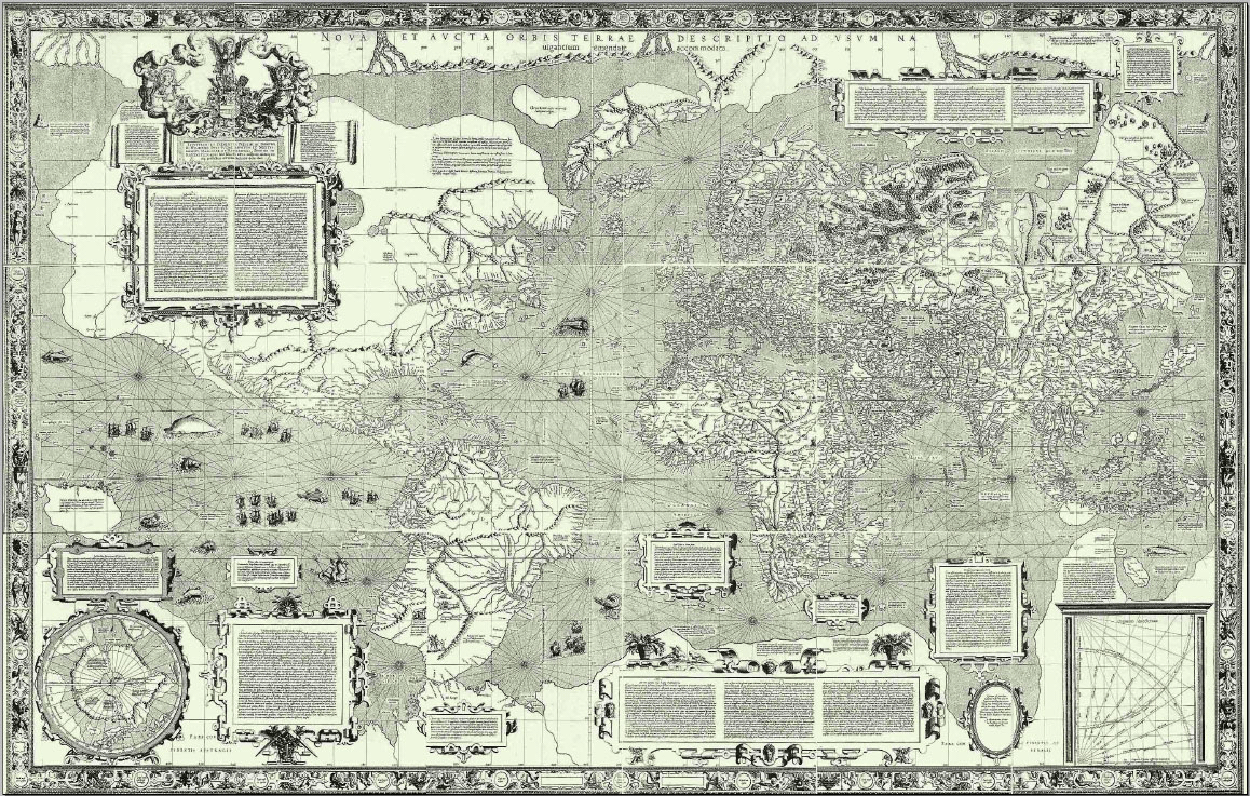
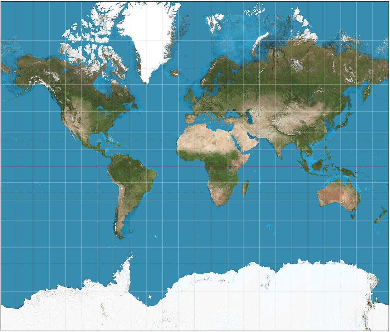
Gerardus Mercator’s world map dates from 1569. The scale is equal in all directions around any point, which keeps the angles and shapes of small objects intact. It worked really well for nautical navigation (which at that time was extremely important) because routes without changes of direction are straight, and consequently this projection became the standard. All map projections obviously distort the globe as they translate it to a flat surface, and the Mercator projection has a serious level of distortion the farther it moves from the equator. Greenland and Antarctica are quite substantial, to put it mildly. Europe is larger than it should be, which suited everyone back then.

Nevertheless, the projection has been a staple component of atlases until relatively recently. This site shows the Mercator-effect scale differences. Try it: goo.gl/7ks7hy

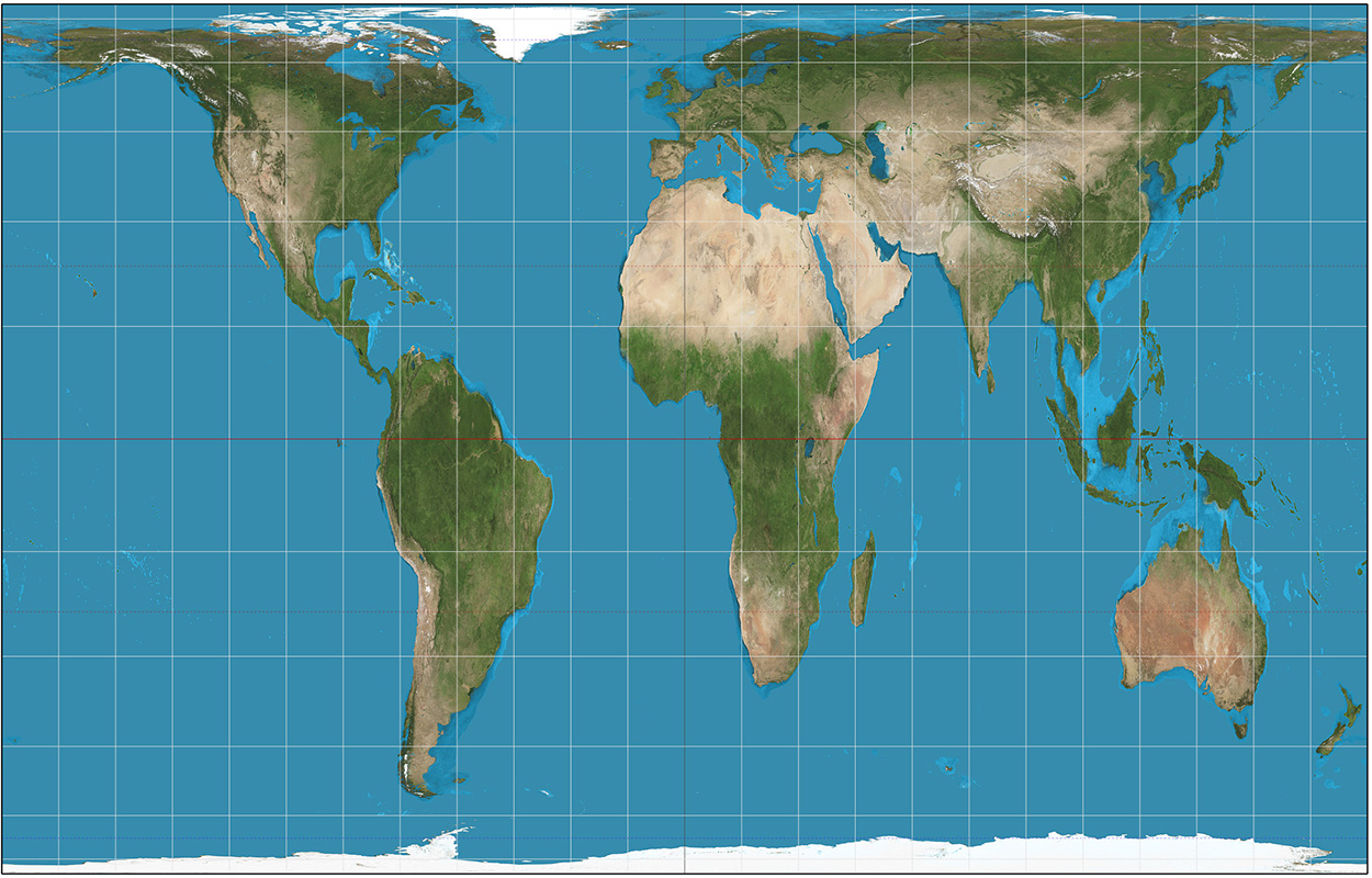
By contrast, the Gall-Peters projection accurately shows the relative size of land areas, but there’s considerable distortion, especially along the equator and at the poles. Also, like the Mercator, distances are not consistent. Consequently, many cartographers are not convinced that this is the way to go either. Nevertheless, UNESCO and UNICEF support this projection as a way of showing a fairer representation of the relative size of the developing countries.

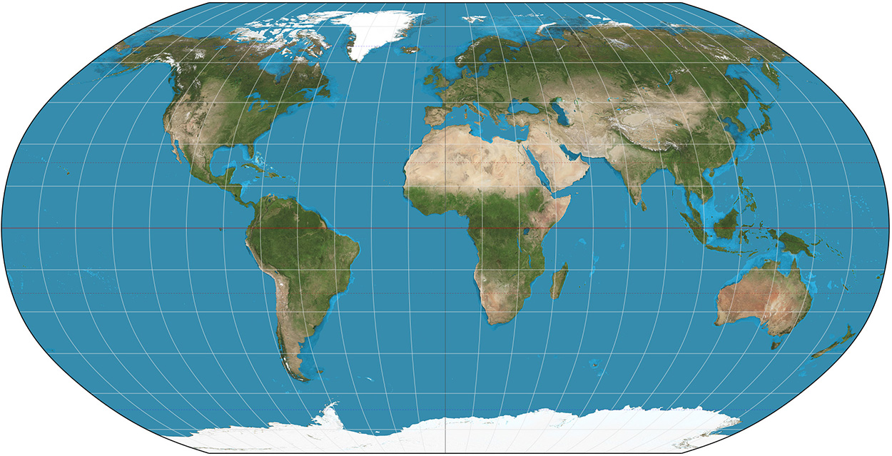
I’ve always liked the Robinson projection. It doesn’t tick all the boxes, but at least the land areas look something like they do on a globe.

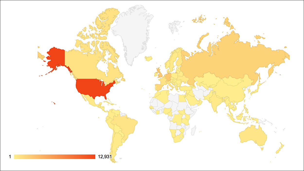
Many online applications (like Google Maps and OpenStreetMap) use a variant of the Mercator projection called Web Mercator. Why? Because with it’s parallel longitude and latitude lines, it scales really well from large-scale maps to local views, and north is always vertical. Distortion on a local scale is minimal. (I’ve been to the location below a lot in the last few years.)

Here’s a WordPress map of views of this blog. No readers in super-sized Greenland. So far.

Mercator, Gall-Peters and Robinson images by Strebe.